About All Tours Boat ToursSun Island Tours2-Day ToursFrom Cusco ToursFrom La Paz ToursAnd Machu Picchu Tours Directions Hours & Fees
Find Tours 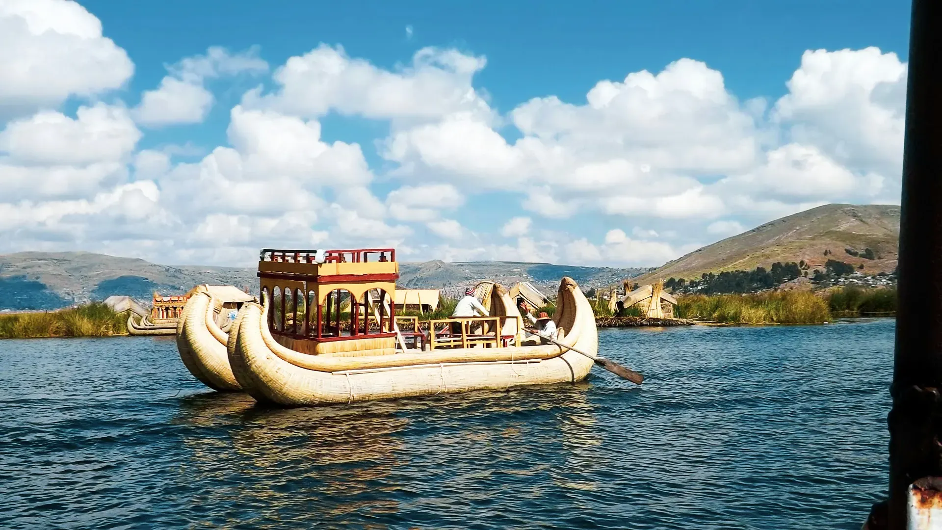
Lake Titicaca spans the border of Peru and Bolivia at 3,812 meters above sea level. It holds 900 cubic kilometers of water and sustains indigenous communities living on man-made floating islands.
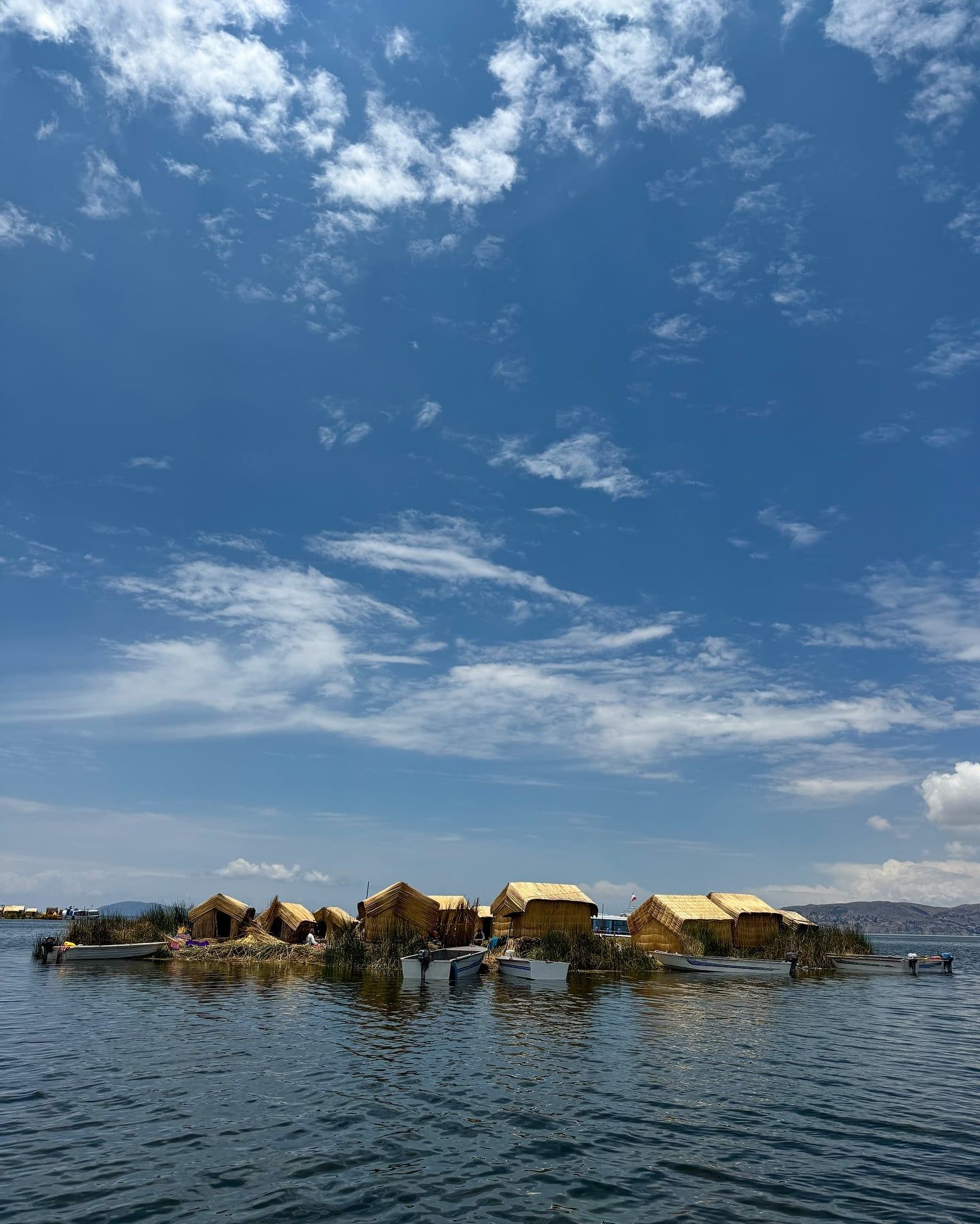
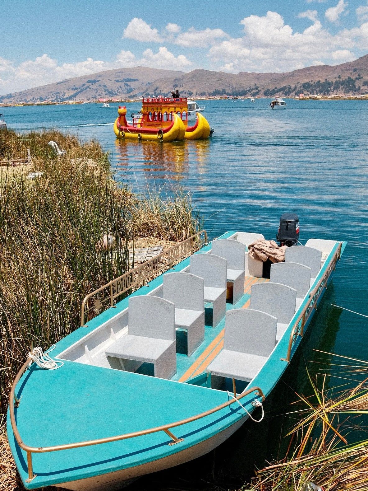
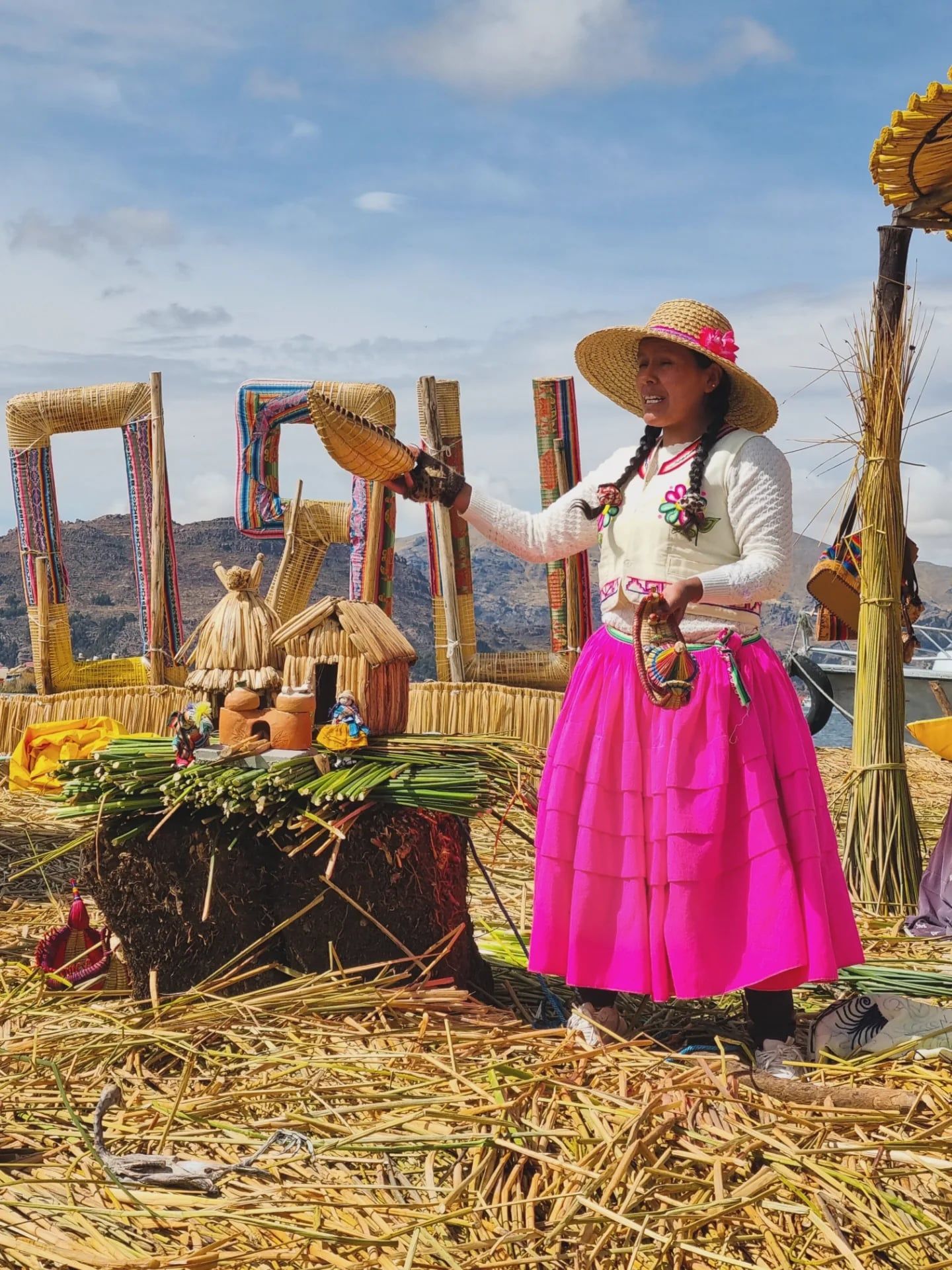
Lake Titicaca spans 8,300 square kilometers across the high Andes border, with 60 percent of its waters in Peru and 40 percent in Bolivia. At 3,812 meters above sea level, the thin atmosphere causes the sun to reflect intensely off the deep blue surface. Visitors board small motorboats from the concrete docks in Puno to navigate a network of over 40 islands scattered across the vast basin. The Uros people construct their floating settlements entirely from native totora reeds, stacking fresh green layers every few weeks as the submerged stalks rot away. Walking on these man-made platforms feels like stepping onto a giant, springy sponge.
The lake holds 900 cubic kilometers of water, fed by 27 distinct rivers including the Ramis, Coata, and Ilave. Evaporation claims 95 percent of this volume due to the punishing high-altitude sun and dry mountain winds. Travelers face steep, uneven stone paths on natural islands like Taquile and Amantaní. Local families farm these terraced hillsides entirely by hand, completely rejecting the use of modern machinery or vehicles. Nighttime temperatures frequently drop below freezing during the dry months of June to August, requiring heavy thermal layers and thick wool blankets. Local authorities enforce a strict ban on single-use plastics across the islands to protect the fragile aquatic ecosystem.
Heavy downpours and lightning strike the region from November to April, turning dirt trails into thick mud. February brings the peak of the rainy season, forcing boat operators to cancel trips when water conditions become too dangerous. Travelers reach Puno by taking a seven-hour bus ride covering 389 kilometers from Cusco, or by flying into Juliaca Airport and driving 45 kilometers south. Travelers can also arrive via the PeruRail Titicaca train, a 10.5-hour daylight journey from Cusco that crosses the high pass of La Raya. Standard boat tours last between three and five hours for quick sightseeing, while comprehensive experiences require two to three days. Visitors must check weather conditions at the Puno port early in the morning before purchasing their 30-sol entrance ticket.
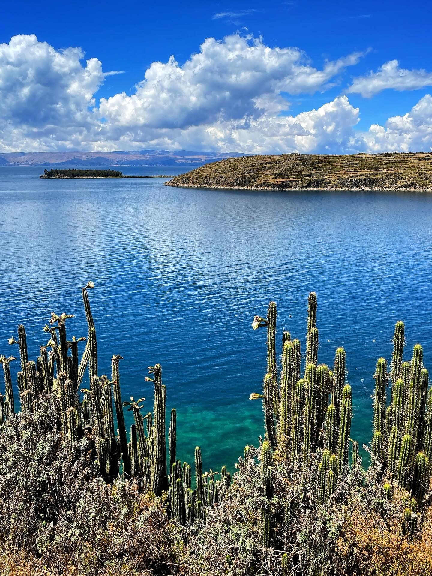
Long before written records existed, the Aymara and Quechua peoples established complex agricultural societies along the 3,812-meter-high shores. They harvested the abundant totora reeds to build crescent-shaped boats and fished the freezing waters to sustain their growing populations. The Tiwanaku culture dominated the southern basin from 500 to 1000 CE, constructing massive stone monuments and sophisticated raised-field agricultural systems that protected crops from frost. To the north, the Kolla civilization built towering cylindrical stone tombs called chullpas at Sillustani. These structures reach 40 feet high and feature precise stone masonry used to bury their elite leaders. Around 1100 CE, the Inca Empire expanded into the basin and absorbed these local groups. The Incas integrated the massive body of water directly into their core creation myth. They claimed the sun god Inti sent the first Inca king, Manco Capac, and his wife, Mama Ocllo, emerging directly from the dark waters to civilize the earth and found the city of Cusco. On Isla del Sol, accessible by boat from Copacabana, over 180 ancient Incan ruins remain intact. Hikers can walk along ancient stone roads to reach the sprawling and well-preserved Templo del Sol, gazing at the snow-capped peaks of the Cordillera Real mountain range.
Spanish conquistadors arrived in the 1530s, bringing Catholicism, new diseases, and colonial architecture to the high Andes. They built imposing structures like the 17th-century red sandstone Dominican Church in Pomata, forcing local populations to labor in silver mines. Indigenous communities retreated to the lake's isolated islands to preserve their customs and escape forced labor. The Uros people moved their entire society onto the water, weaving floating platforms from reeds to evade mainland conflicts. This defensive strategy allowed them to maintain their distinct language and culture for centuries while mainland populations assimilated into the Spanish colonial system.
International archaeological divers plunged into the 14°C waters in the year 2000 and found the remains of a massive temple measuring 200 meters long by 50 meters wide. This submerged structure, along with a terrace for crops and a pre-Inca road, proved the existence of complex societies operating directly on the lakebed before ancient climate shifts caused water levels to rise. Today, families on Taquile Island maintain their ancestral textile traditions, with men learning to knit complex patterns starting at age eight. The Peruvian government legally bans cars and machinery on Taquile to preserve this centuries-old agricultural lifestyle. Visitors pay a 30-sol entrance fee to access specific regional sites, funding local conservation efforts and supporting the indigenous communities that still rely on the lake for their daily survival.
The lake divides into two distinct bodies of water connected by the 800-meter-wide Tiquina Strait. Lake Grande, also known as Chucuito, dominates the northern section and contains the deepest waters. The shallower Lake Pequeño, or Huiñaymarca, sits to the south. The entire basin measures approximately 190 kilometers in length and 80 kilometers at its widest point, reaching a maximum depth of 284 meters near Isla Soto. Water temperatures remain a constant, dangerous 14°C (55°F) year-round, making swimming a severe hypothermia risk for unprotected humans. The surrounding landscape features rolling hills and steep, terraced slopes that drop sharply into the dark blue water.
Totora reeds grow densely in the shallow coastal zones, particularly around the Bay of Puno. These thick, green stalks provide the primary building material for the Uros floating islands, traditional boats, and local roofs. The white base of the reed is edible, supplying a crucial source of iodine to the indigenous diet. The lake supports 530 distinct aquatic species, including native killifish and catfish. The most famous resident is the critically endangered Lake Titicaca water frog. This unique amphibian features excessive, baggy skin that allows it to absorb oxygen directly from the water, enabling it to survive at high altitudes without surfacing to breathe. Adult frogs can weigh over two pounds and measure up to 20 inches long. The lake also supports 95 distinct bird species. Visitors hiking along the well-maintained paths of the Capachica Peninsula can spot native water birds diving into the mirror-like water.
High winds whip across the surface, particularly during the dry month of August, creating choppy waves that easily induce motion sickness on small tour boats. The thin atmosphere at 12,500 feet offers zero protection from the sun, causing severe UV damage to unprotected skin within minutes. Visitors must apply high-SPF sunscreen, wear polarized sunglasses, and cover exposed skin with long sleeves. Wheelchair travel presents major physical obstacles. Standard tour boats require passengers to navigate narrow wooden planks and steep stairs. Specialized agencies provide portable ramps and personal assistants to help mobility-impaired travelers access the islands safely.
Quechua and Aymara communities revere the lake as the birthplace of the sun and the cradle of the world. Andean mythology dictates that the creator god Viracocha rose from these dark waters to summon the sun, moon, and stars into existence. Local residents maintain strict spiritual connections to the water, performing agricultural rituals and offering coca leaves to Pachamama (Mother Earth) to ensure successful potato and quinoa harvests. The nearby town of Chucuito houses the Temple of Fertility, a walled complex containing rows of ancient stone statues of male genitalia where women historically performed fertility rituals. A short boat ride from Isla del Sol brings travelers to Isla de la Luna. This isolated island features ancient stone ruins where chosen women, known as the Virgins of the Sun, lived and performed religious ceremonies during the Inca rule.
On Taquile Island, textile production dictates social standing and marital status. Men wear specific colored chullos (knitted hats) to indicate their position in society. A red and white knitted hat signals a single man, while a solid red hat indicates he is married. The men also weave wide calendar waistbands that depict the annual agricultural cycles and local weather patterns. The United Nations Educational, Scientific and Cultural Organization recognized this specific knitting tradition as an Intangible Cultural Heritage of Humanity in 2005.
The Candelaria Festival erupts in the lakeside city of Puno every February 2nd. Over 300 traditional dance troupes fill the streets for 18 consecutive days, wearing heavy, elaborate masks and brightly embroidered costumes to honor the city's patron saint. Brass bands play continuously while dancers perform the Diablada, a traditional dance representing the fight between good and evil. Visitors attending homestays on Amantaní Island participate directly in these cultural exchanges. Guests eat fresh lake trout in mud-brick kitchens and hike to the highest peaks of the island to view the ancient Pachatata and Pachamama temples. Local customs dictate that visitors bring useful gifts like cooking oil, rice, or school supplies rather than sugary snacks for their host families.
The critically endangered Lake Titicaca water frog has baggy skin that allows it to absorb oxygen underwater and can weigh over two pounds.
On Taquile Island, men exclusively handle the knitting, learning the complex craft from the age of eight.
Despite receiving water from 27 different rivers, the lake loses 95% of its volume to intense high-altitude evaporation.
In 2000, divers found a 200-meter-long pre-Inca temple resting at the bottom of the lake.
Taquile Island legally bans all cars, hotels, and modern machinery, requiring all agricultural work to be done by hand.
The white base of the totora reed, used to build the Uros floating islands, is edible and provides iodine to the local diet.
The nearby town of Chucuito features an ancient walled complex filled with large stone statues of male genitalia.
Swimming is highly dangerous due to the extreme cold. The surface temperature stays around 14°C (55°F) year-round, posing a severe risk of hypothermia and rapid physical exhaustion. Visitors should stay securely inside their tour boats.
The lake sits at an elevation of 3,812 meters (12,507 feet). Visitors need 24 to 48 hours of rest upon arrival to acclimatize to the thin air and avoid severe altitude sickness.
Locals stack thick layers of organic totora reeds harvested from the shallow parts of the lake. They must constantly add fresh reeds to the top as the bottom layers rot away in the water.
The dry season from May to October provides clear skies and excellent visibility. June to August offers the most stable weather, though nighttime temperatures frequently drop below freezing.
The lake reaches a maximum depth of 284 meters (920 feet). It holds a massive total water volume of 900 cubic kilometers across its two main basins.
Public buses complete the 389-kilometer journey in about seven hours. Travelers can also book the luxury PeruRail Titicaca train, which takes 10.5 hours and features on-board meals.
Taquile Island strictly prohibits cars and modern machinery. Families rely entirely on manual labor for agriculture and use small solar panels or candles for light.
No general permit is required, but visitors must buy boat tickets at the docks. Certain regional sites and trailheads charge an entrance fee of 30 soles for foreigners, payable in cash.
Bring high-SPF sunscreen, polarized sunglasses, and a wide-brimmed hat to block the intense UV rays. Pack heavy thermal layers and a warm jacket for the freezing evening temperatures.
The ecosystem supports 530 aquatic species and 95 bird species. The most famous resident is the giant Lake Titicaca water frog, which absorbs oxygen through its oversized folds of skin.
Browse verified tours with free cancellation and instant confirmation.
Find Tours